Decisions are only as good as the quality of the data on which the decision is made. By providing centimeter-accurate GPS as a simple, affordable, and on-demand service, Trimble is enabling a new category of users to try more efficient methods of mapping, layout, measurement, and navigation in outdoor environments, shares Gareth Gibson, Business Development Manager, Trimble Catalyst in an exclusive interview.
How are Mapping & GIS products improving productivity in industries?
Mapping & GIS products add a layer of location context to everything from consumer spending habits, to inventory management, to industrial maintenance needs. With location intelligence, businesses can more efficiently allocate their resources by determining what work needs to be done, where it needs to be done, and when it needs to occur. Mapping & GIS products allow spatial data to be visualized in more understandable ways, and in doing so reveal valuable insights. Combining information with physical location information creates a richer canvas for data analysis, and enables intuitive visualizations for stakeholders to understand large amounts of data, allowing the information to be more easily shared across an enterprise.
What are the benefits of Geo-enabling field workforces?
Everything happens somewhere. This is an obvious but under-appreciated business truth. By adding a layer of location intelligence to business information, and making that data available in easily consumable formats in the field as well as the office (for example, easy-to-use maps, or geo-enabled work order management tools), whole workforces become empowered to make serious and often expensive decisions on-the-go, in real time. Rather than needing to wait for permission, more information, or further analysis, the geo-enabled field workforce has access to location-enriched information at their fingertips. Users across an organization can make more accurate and timely business decisions by sharing data between the field and the office more efficiently.
How is Trimble Catalyst facilitating the use of GIS for better productivity?
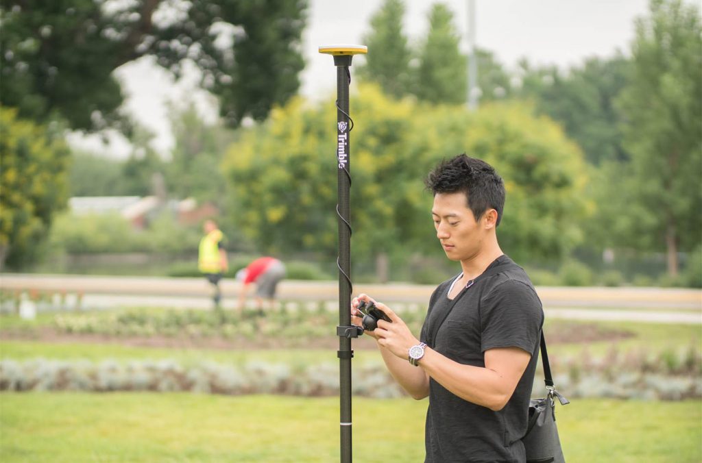
Decisions are only as good as the quality of the data on which the decision is made. Trimble® Catalyst™ is a tool for providing highly precise GPS location and positioning data to field users, as they work. By providing centimeter-accurate GPS as a simple, affordable, and on-demand service, Trimble is enabling a new category of users to try more efficient methods of mapping, layout, measurement, and navigation in outdoor environments. Whereas previously the use of high-accuracy GPS was the exclusive domain of the GIS professional, now anyone with a smartphone can begin experimenting and seeing the benefits of using the precision GPS technology as an alternative way to do their work.
Please explain the concept of subscription-based software GNSS receiver
Trimble has taken the GPS receiver, which is traditionally a piece of physical electronic hardware, and implemented it as a software application which simply runs as an app on everyday Android phones and tablets. A small, low-cost antenna plugs into the USB port of the Android device to provide a ‘clean’ GPS signal to the Catalyst app, and the app is enabled with a subscription with pricing determined by the accuracy-level required by the customer’s application. Catalyst subscriptions are available for individuals or groups of users for as little as a month at a time, which allows the service to be scaled for use by organizations of any size (from owner-operators to SMBs, right through to enterprise-sized companies equipping entire field fleets) and for projects of any duration, while only paying for what is used. Today the service is available in accuracies ranging from one meter to 1-2 centimeters. In order to deliver this level of accuracy, Trimble bundles access to GNSS corrections through a companion offering called the Trimble Corrections Hub, which provides access to Trimble’s corrections services around the world including Trimble RTX™ technology and Trimble VRS Now™ service. Catalyst can be accessed directly on the phone and used by other location-enabled apps. Or by using the Trimble Catalyst SDK developers can embed the service directly into apps for streamlined field workflows.
 How popular is Trimble Catalyst in the market? How much transformation has it brought in the mapping industry?

One of Trimble’s objectives with delivering this solution is to provide access to anywhere from meter to centimeter-accurate field workflows for all users—not just geospatial professionals and surveyors. For the first time, we are starting to see this goal become a reality. We have seen a large interest from new customers in many different industries, both from new customers for whom high-accuracy GPS workflows have been prohibitively expensive or complicated, and from existing customers looking to expand the use of GPS technology to more workers. Trimble Catalyst is changing the way people think about using GPS, especially in terms of how it is budgeted for and paid for within a company. Where traditionally high-end GNSS workflows required a lot of planning and budgeting and upfront expense, now with Catalyst the cost of entry is almost eliminated. High accuracy GPS as a tool can now be considered as a project operating expense, turned on or off, and scaled or modified from one project to the next as business requirements change.
Which are the major areas of application for Trimble Catalyst?
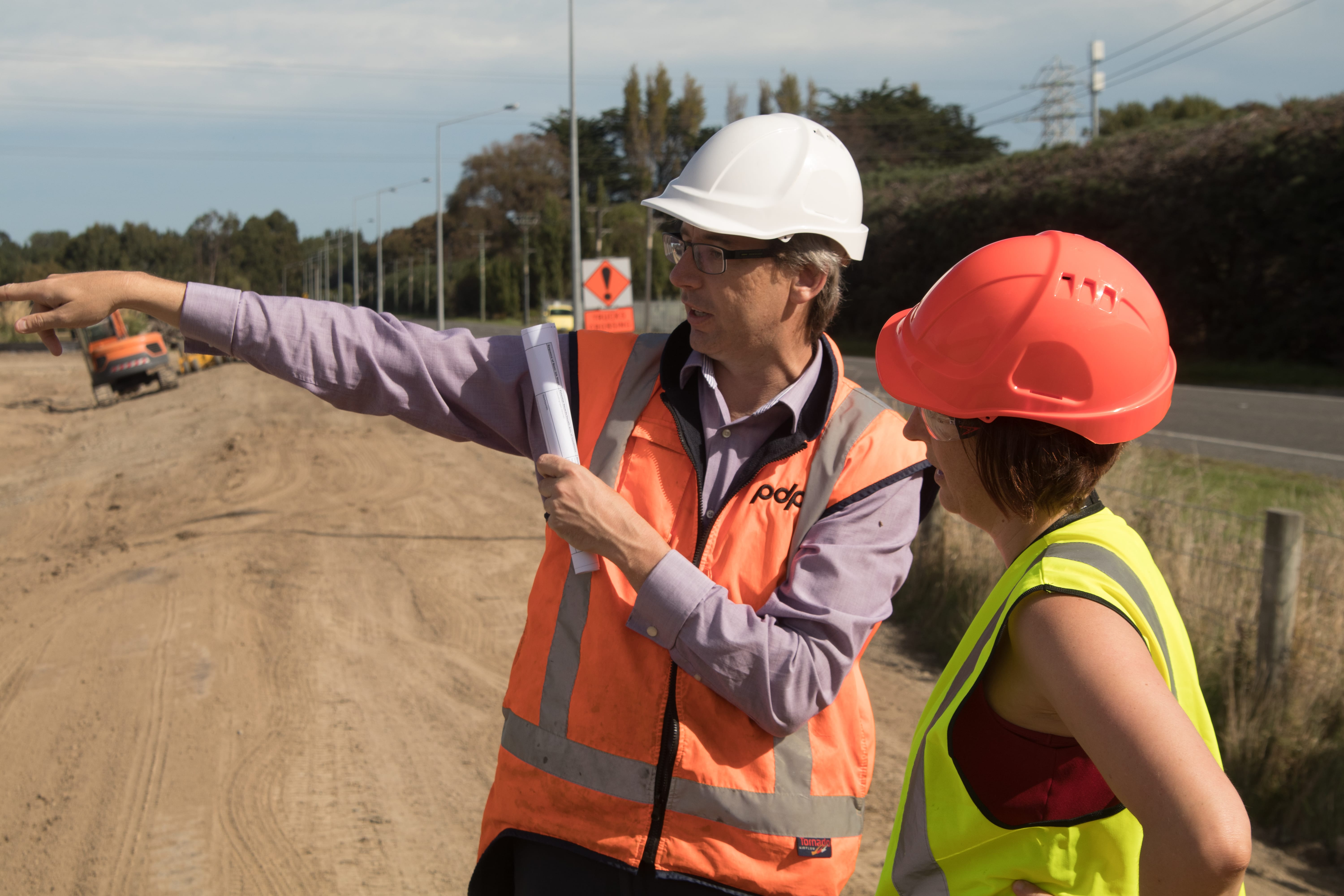
We are constantly being surprised by the new ways that our existing and new Catalyst users are deploying this in the real world. Broadly speaking, applications of Catalyst can be broken into traditional and non-traditional use. We have our traditional users, deploying Catalyst with traditional field mapping apps like Trimble TerraFlex™, or apps from our partners such as Esri’s Collector for ArcGIS®. This category of users is enjoying the advantages of the added flexibility that Catalyst brings for traditional mapping and asset inspection projects. We are also seeing the growth of a new market of non-traditional workflows too. For example, in Forestry and Agriculture, we have users starting to experiment with the use of Catalyst in field vehicles and heavy machinery. In the Drone and aerial mapping sector, we have a growing number of users running Catalyst as a convenient method for capturing ground control – including a successful deployment from 3DR who has used our SDK to integrate Catalyst into a dedicated GCP add-on for the SiteScan platform. Catalyst is also starting to gain a foothold in industries with field maintenance and installation workflows where industries that have not used GPS before are starting to realize that this technology can streamline their own field workflows—whether that is improving record-keeping, or capturing a digital as-built records to make maintenance tasks more efficient for future fieldwork. Industries ranging from urban irrigation to parks maintenance, to event management teams have been starting to see real benefits in this technology. These are all industries where using GPS tools has previously been inaccessible—either because the technology was too complex, too expensive, or workflows simply didn’t exist. Catalyst is breaking down these barriers and making the technology accessible.
Please share a success story.
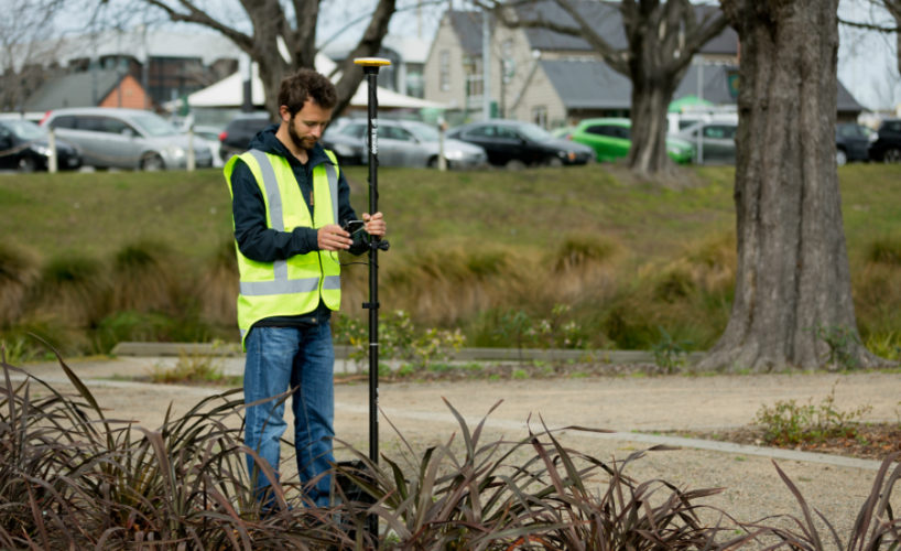
Pattle Delamore Partners Ltd. (PDP) had a problem. As an environmental engineering agency in New Zealand, they work on projects of varying size, complexity, and sensitivity. Accuracy is crucial for their work. Phone-based GPS simply wasn’t reliable or accurate enough for their needs, but purchasing professional survey systems for their field crew simply wasn’t cost-effective either. Hiring another company to do it may have solved the problem once, but they were undoubtedly going to have to face this issue again.
They discovered Trimble Catalyst, and recognized straight away that the flexibility, ease of use, and scalability of the Catalyst service was an excellent match for the way their business operates.
With Trimble Catalyst, they have been able to provide a low-cost, high-accuracy GPS solution to all of their field teams. They can quickly capture the data and precise measurements in the field and can easily scale the service up and down as their requirements change. Once a job is completed, the Catalyst subscriptions can be shut off and the antennas can be put on the shelf waiting for the next opportunity to be used.
Contact @ ASIM NAVIGATION INDIA PVT LTD for the details and pricing of the product.
Contact: 011-45558010 , www.asimindia.com, www.asimindia.in for more details.