What is GAGAN?
The GPS aided geo augmented navigation or GPS and geo-augmented navigation system (GAGAN) is a planned implementation of a regional satellite-based augmentation system (SBAS) by the Indian government. It is a system to improve the accuracy of a GNSS receiver by providing reference signals.
The project is being implemented in three phases through 2008 by the Airport Authority of India with the help of the Indian Space Research Organization’s (ISRO) technology and space support. The goal is to provide navigation system for all phases of flight over the Indian airspace and in the adjoining area. It is applicable to safety-to-life operations, and meets the performance requirements of international civil aviation regulatory bodies.
To begin implementing an SBAS over the Indian airspace, Wide Area Augmentation System (WAAS) codes for L1 frequency and L5 frequency were obtained from the United States Air Force and U.SDepartment of Defense on November 2001 and March 2005. The system will use eight reference stations located in Delhi, Guwahati, Kolkata, Ahmedabad, Thiruvananthapuram, Bangalore, Jammuand Port Blair, and a master control center at Bangalore.

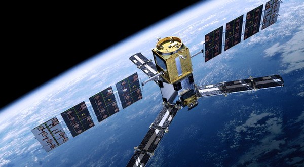
GAGAN, after its final operational phase completion, will be compatible with other SBAS systems such as the Wide Area Augmentation System (WAAS), the European Geostationary Navigation Overlay Service (EGNOS) and the Multi-functional Satellite Augmentation System (MSAS) and will provide seamless air navigation service across regional boundaries. While the ground segment consists of eight reference stations and a master control centre, which will have sub systems such as data communication network, SBAS correction and verification system, operations and maintenance system, performance monitoring display and payload simulator, Indian land uplinking stations will have dish antenna assembly. The space segment will consist of one geo-navigation transponder.
With Trimble DGPS Systems Has the capability to capture the GAGAN satellites and give the real time correction on the Ground. With this system , the real time accuracy of the system Juno Series and Geo Series such as Geo-XT 3000 and Geo-XH 6000, the accuracy and productivity of the system increases.
What is WAAS?
You’ve heard the term WAAS, seen it on packaging and ads for Garmin® products, and maybe even know it stands for Wide Area Augmentation System. Okay, so what the heck is it? Basically, it’s a system of satellites and ground stations that provide GPS signal corrections, giving you even better position accuracy. How much better? Try an average of up to five times better. A WAAS-capable receiver can give you a position accuracy of better than three meters 95 percent of the time. And you don’t have to purchase additional receiving equipment or pay service fees to utilize WAAS.
What is WAAS?
The Federal Aviation Administration (FAA) and the Department of Transportation (DOT) are developing the WAAS program for use in precision flight approaches. Currently, GPS alone does not meet the FAA’s navigation requirements for accuracy, integrity, and availability. WAAS corrects for GPS signal errors caused by ionospheric disturbances, timing, and satellite orbit errors, and it provides vital integrity information regarding the health of each GPS satellite.
How it Works?
WAAS consists of approximately 25 ground reference stations positioned across the United States that monitor GPS satellite data. Two master stations, located on either coast, collect data from the reference stations and create a GPS correction message. This correction accounts for GPS satellite orbit and clock drift plus signal delays caused by the atmosphere and ionosphere. The corrected differential message is then broadcast through one of two geostationary satellites, or satellites with a fixed position over the equator. The information is compatible with the basic GPS signal structure, which means any WAAS-enabled GPS receiver can read the signal.
Who benefits from WAAS?
Currently, WAAS satellite coverage is only available in North America. There are no ground reference stations in South America, so even though GPS users there can receive WAAS, the signal has not been corrected and thus would not improve the accuracy of their unit. For some users in the U.S., the position of the satellites over the equator makes it difficult to receive the signals when trees or mountains obstruct the view of the horizon. WAAS signal reception is ideal for open land and marine applications. WAAS provides extended coverage both inland and offshore compared to the land-based DGPS (differential GPS) system. Another benefit of WAAS is that it does not require additional receiving equipment, while DGPS does.
Other governments are developing similar satellite-based differential systems. In Asia, it’s the Japanese Multi-Functional Satellite Augmentation System (MSAS), while Europe has the Euro Geostationary Navigation Overlay Service (EGNOS). Eventually, GPS users around the world will have access to precise position data using these and other compatible systems.

It just keeps getting better
100 meters: Accuracy of the original GPS system, which was subject to accuracy degradation under the government-imposed Selective Availability (SA) program.
- 15 meters: Typical GPS position accuracy without SA.
- 3-5 meters: Typical differential GPS (DGPS) position accuracy.
- < 3 meters: Typical WAAS position accuracy